
Find Onondaga Street Directory Records
Start with one exact situs address, then build a dated chain. Onondaga County's assessment and mapping systems can identify the parcel that corresponds to a road address. The assessment card supplies an owner of record and a deed book and page, while the deed index supplies a recorded transfer trail. An individual voter lookup or a dated directory entry can sometimes add a separate association, but neither turns the assessment record into a list of everyone on a street. That distinction keeps a street directory useful without overstating what a record proves.
Keep the physical address, the postal city, the tax-map identifier, the SWIS code, and the source date together. A Town of Onondaga address can carry a Syracuse mailing label, and an owner's mailing address can be elsewhere. The municipality is resolved with the parcel and local assessment record, not from the postal string alone.
- Enter the number and street in Onondaga County Image Mate. The county advises using one search item at a time, then refining the result.
- Record the parcel or tax-map number and SWIS from the assessment result. Compare the situs field and owner mailing field instead of treating them as the same address.
- Open the parcel in Onondaga County GIS and use parcel, district, aerial, flood, or zoning layers as map context.
- Use the deed book and page with the County Clerk eSearch index, then follow the prior instrument reference backward.
- For a dated person or household question, use the individual New York voter lookup as limited corroboration and consult older directories at the library. Neither is a street-wide roster.
Use Onondaga Street Addresses in Image Mate
Image Mate is the public assessment-search entry point for an Onondaga street directory. Its documented choices are Tax Map Number, Owner Name, Property Address, and Mailing Address. Use the physical-address route for a location on the road, and use Mailing Address only when researching where the assessment office sends tax correspondence. The county describes the information as subject to change and directs users to the town assessor for confirmation.
The Image Mate assessment search displays the county's one-item-at-a-time approach before a search is refined.
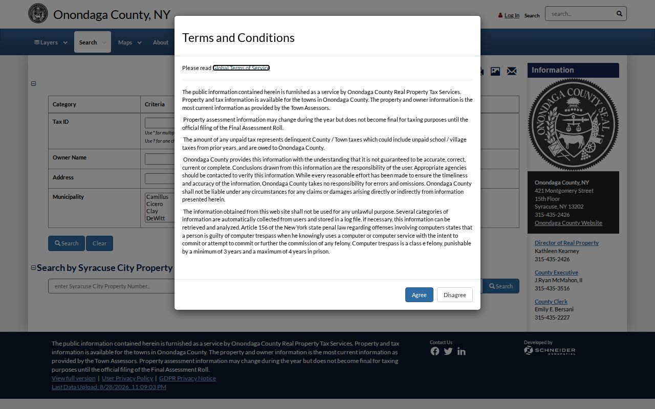
That first search is a way to locate the record, not a conclusion about present occupancy. The Town assessor, Michael Morrissey, can reconcile a roll discrepancy at 315-469-3216, and the assessor office is at Town Hall, 5020 Ball Road.
| Image Mate field | Best use on a street search |
|---|---|
| Tax Map Number | Strongest parcel key when an address is abbreviated, shared, or has changed. |
| Owner Name | Search the name as shown in the deed or assessment, then test spacing or surname variants. |
| Property Address | Find the physical situs by number and street. |
| Mailing Address | Find an assessment correspondence address, which may be outside the Town. |
Map an Onondaga Street Parcel
The county GIS division maintains a countywide viewer that supports the Town of Onondaga as well as other municipalities. After an address or parcel is identified, GIS is useful for checking the outline, nearby roads, tax parcels, districts, zoning, flood layers, and aerial context. It helps answer whether two records appear to concern the same mapped land.
A map click is not a legal boundary determination. Onondaga parcel polygons began as paper-map digitization in 1995, received CAD updates through 2024, and migrated to ESRI in 2024. The metadata also warns that condominium polygons can overlap. When an identify action returns more than one result, keep the tax-map identifier and legal description with the result rather than choosing a record by visual position.
Note: Annual tax maps are updated in March, so record the map and roll year before comparing an older address to a newer parcel display.
Read Onondaga Street Fields Separately
Two official parcel-card examples show why the fields in an address record need labels. A 2022 card pairs the Cook Road situs with a Thayer Street mailing address in Syracuse. A 2025 card pairs a Horseshoe Is Road situs with a nearby mailing address carrying a Clay postal label. Those are assessment facts, not evidence that a named owner lives at either address. They also do not change the Town of Onondaga parcel's municipal identity.
Use the assessment card's deed book and page as the bridge to the County Clerk. Then compare the valuation date, taxable-status date, roll year, and deed recording date. A roll can reflect a later administrative update than a recorded instrument. When a parcel has split, merged, or changed form, preserve the older legal description before mapping it to a modern parcel.
- Parcel
- A tax-map unit of land used in assessment and mapping. It can change through a split, merger, or condominium arrangement.
- Situs address
- The physical property location recorded by the assessor. It is distinct from the owner mailing address.
- Plat or tax map
- A map product that depicts parcels and related geography. It supports location research but does not replace the recorded deed.
- Criss-cross directory
- A reverse directory arranged by address, useful for a dated entry when a volume actually covers the street.
Trace an Onondaga Street Deed Chain
The Onondaga County Clerk holds deeds and mortgages from 1794 forward, but the practical chain begins with a known parcel, current owner, or deed reference. In eSearch, a guest may search the index without charge. Images require an account or subscription, and not every indexed record has an image. The Clerk's Real Property, Mortgages & Deeds office is at 401 Montgomery Street, Room 200, Syracuse, and can be reached at 315-435-8250.
Copy the grantor, grantee, instrument type, recording date, book and page, legal description, and prior-reference language for each deed. Follow that prior reference rather than assuming a similarly named person or nearby parcel belongs in the chain. Older handwritten indexes may need a spelling variation, archive assistance, or an in-person check. The Clerk notes a compound-name tip for older records: search the second component with the last-name criterion set to Contains; the tip does not apply after August 21, 2017.
A deed records a conveyance. A mortgage records a financing or security interest. An easement or right-of-way is not an ownership transfer, and none of these documents identifies who was physically present at the address on a given day.
Compare Onondaga Street Directory Records
Address-keyed sources can be combined when their dates and roles agree. They cannot be merged into a single current-resident list. The table separates what each record type actually contributes and points to the access route when the online result is incomplete. For a street search, that separation is more reliable than treating every name attached to an address as the same kind of evidence.
| Address-keyed source | Custodian | What it documents | Access route |
|---|---|---|---|
| Assessment roll and parcel card | Town assessor and county Image Mate | Assessment owner, mailing field, parcel, roll dates, and deed book/page | Public search, roll links, or assessor confirmation |
| Parcel and tax maps | County GIS and RPTS | Parcel geography, district layers, and annual map context | Online viewer; individual maps through RPTS or the Civic Center |
| Recorded deed index | Onondaga County Clerk | Recorded conveyance and legal-description trail | Guest eSearch index, account image access, counter, archive, phone, or copy request |
| Registration and polling result | NYS lookup and County Board of Elections | Individual registration or polling information, subject to public-field limits | Online individual lookup, Board office, or request for an existing report |
| Permit, inspection, or code file | Town Building and Codes | Existing address-specific municipal file, if retained and releasable | Department request or Town Clerk FOIL form |
| Older directories and newspapers | OCPL and local-history repositories | Dated directory, phone, obituary, or newspaper reference | Library visit, staff query, phone, email, or copy request |
Registration records are public under Board supervision, but protected identifiers are not public. The state lookup accepts county, last and first name, date of birth in MM/DD/YYYY format, ZIP, and address information. It is an individual registration and polling tool, not a way to scan a road for names.
Request Onondaga Street Permit Records
Town Building and Codes handles permits, inspections, complaints, zoning, and subdivision material. The public page supplies a building-permit application, but research did not locate an all-permit portal that can be searched across Town addresses. Request an existing file by exact situs address or tax-map number and provide a date range. The Codes office can be reached at 315-469-3144.
If a record is not available from the department, use the Town Clerk FOIL request form for an existing, described record series. The Town form recommends a property address or tax ID for parcel requests. The Town Clerk is the municipal records custodian at 5020 Ball Road; the form also explains inspection, copies, and an appeal route. A request cannot require staff to reconstruct a whole street history or create a new directory.
Keep Older Onondaga Street Names Dated
For an older address, a current parcel may be the bridge, not the answer. County Clerk records can use a lot, tract, farm, or older road description. Search the old and modern street terms, then compare the legal description, tax-map history, and map date before joining them. Research did not locate a complete official Town street-renaming or house-number crosswalk, so an unresolved transition should remain labeled as uncertain.
OCPL's Local History and Genealogy collection holds Syracuse directory runs from 1844 forward, with microfiche from 1844 to 1860, microfilm from 1862 to 1935, and paper volumes from 1936 forward. Those volumes may mix city, suburban, and Town entries. Search the road, a named hamlet, and the county, then cite the year and page. For a fuller treatment of those dated volumes, use the Onondaga historical city directory.
The Town Historical Society and Museum at Town Hall, the County Clerk archives, and OCPL each supply a different fallback route when an online address query fails. A useful request names the map, directory year, newspaper period, permit series, or deed index needed, rather than asking staff to infer a person from a street name.
Use Onondaga Street GIS With Care
GIS is especially useful where a Town street crosses a postal boundary or shares a name with another road. The county viewer can show a parcel edge and district layers, but a visually adjacent polygon can be separated by a road, water, a right-of-way, or map topology. A road label also may not tell which municipality owns the parcel on either side.
For a boundary question, compare the map display with the tax-map identifier, SWIS, legal description, and the local assessor's record. The county's generalized ZIP map can add postal context, but it is not parcel-level postal proof. This GIS caution reflects the 2024 ESRI migration and the warning about overlapping condominium polygons, two reasons to preserve the actual parcel identifiers in a street-by-street record.
Note: A map match is a research lead; the recorded instrument and the applicable assessment or tax map supply the stronger documentary link.
Limits of Onondaga Address Records
An address-record trail can show dated property, map, record, and directory associations. It cannot prove every person connected with an address, the present status of a past entry, or the reason a name is absent. A no-result may come from a spelling variation, an unindexed image, an old road description, a parcel change, a directory's limited coverage, list maintenance, or a protected record.
Use the source's own label: assessment owner, owner mailing address, grantor, grantee, permit applicant, directory entry, or registered voter result. Do not convert one category into another. New York's Address Confidentiality Program can place a substitute address in government records, and election records omit protected identifiers. Those lawful limits belong in the final record, along with the custodian and access date.
Lawful use. Use address and public-record information for a legitimate personal, historical, property, or civic purpose. Do not use it to stalk, harass, intimidate, or harm anyone.